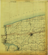
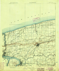
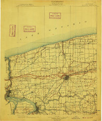
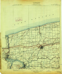
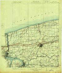
1899 Map of Niagara
USGS Topo · Published 1913About this map
Ft. Niagara stands guard at the confluence of the Niagara River and Lake Ontario, a strategic point of defense shown here alongside the bustling late 19th-century industrial and agricultural landscape of Niagara County. The engineering marvel of the Erie Canal cuts across the terrain toward Lockport, where it meets the Lockport Branch Erie Canal, facilitating heavy trade. The map reveals a dense network of rail lines, including the New York Central and Hudson River R. R. and the Ontario Electric R. R., which connected early settlements like Lewiston and Wilson. Inland, the Tuscarora Indian Reservation occupies a distinct portion of the Cambria and Lewiston townships. From the falls at Niagara Falls and the Whirlpool to the small lakeside hamlets like Olcott and Barker, this survey documents a region defined by its international border and the transition from water-based transport to a modern rail economy.
Find a feature on this map
141 named features on this map. Tap any name to fly to it.
Don’t see what you’re looking for? This feature index may not catch every label — zoom into the map to look around manually.
Map Details
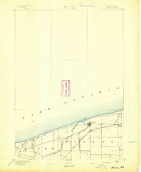
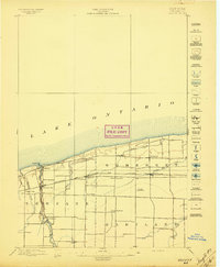
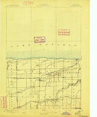
Editions of this 1899 Niagara Map
6 editions found
Other maps of this area

1894 · Buffalo
USGS Topo · 1:62,500

1894 · Niagara Falls
USGS Topo · 1:62,500
1894 · Wilson
USGS Topo · 1:62,500

1896 · Niagara Falls
USGS Topo · 1:62,500

1897 · Tonawanda
USGS Topo · 1:62,500
1897 · Olcott
USGS Topo · 1:62,500

1897 · Medina
USGS Topo · 1:62,500

1897 · Lockport
USGS Topo · 1:62,500
1897 · Ridgeway
USGS Topo · 1:62,500

1899 · Niagara
USGS Topo · 1:125,000