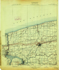
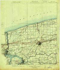
1899 Map of Niagara
USGS Topo · Published 1917About this map
Niagara River frontage and the international boundary with the Dominion of Canada dominate this late nineteenth-century landscape. The industrial and transit hub of Lockport serves as a focal point, where the rail network converges amidst the townships of Royalton and Cambria. Along the northern shore of Lake Ontario, small lakeside settlements like Olcott and Wilson are connected by the Central R. R. and early carriage routes such as Lake Road.
Find a feature on this map
144 named features on this map. Tap any name to fly to it.
Don’t see what you’re looking for? This feature index may not catch every label — zoom into the map to look around manually.
Map Details
Editions of this 1899 Niagara Map
6 editions found
Other maps of this area

1894 · Buffalo
USGS Topo · 1:62,500

1894 · Niagara Falls
USGS Topo · 1:62,500

1894 · Wilson
USGS Topo · 1:62,500

1896 · Niagara Falls
USGS Topo · 1:62,500

1897 · Tonawanda
USGS Topo · 1:62,500

1897 · Olcott
USGS Topo · 1:62,500

1897 · Medina
USGS Topo · 1:62,500

1897 · Lockport
USGS Topo · 1:62,500

1897 · Ridgeway
USGS Topo · 1:62,500

1899 · Niagara
USGS Topo · 1:125,000