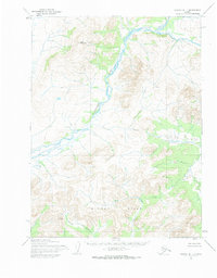
1955 Map of Noatak B-1
USGS Topo · Published 1984About this map
The Agashashok River dominates this mid-century topographic record, winding through a landscape defined by sharp elevation shifts and unnamed ridge systems. Mapped by the Army Map Service using aerial photography from the early 1950s, the terrain is anchored by the prominent Asik Mountain in the northwest. The presence of Knapp Creek and other drainage patterns reflects the complex hydrology of this region within the Northwest Arctic. This survey captures the land in a state largely devoid of permanent roads or developed settlements, providing a clear baseline for studying the natural geography and traditional land use before modern infrastructure. The detailed contour intervals illustrate the literal shape of the hills and valleys that defined local movement and travel routes during this era.
Find a feature on this map
3 named features on this map. Tap any name to fly to it.
Don’t see what you’re looking for? This feature index may not catch every label — zoom into the map to look around manually.
Map Details
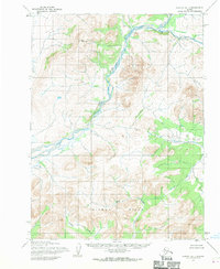
Editions of this 1955 Noatak B-1 Map
2 editions found
Other maps of this area

1951 · Baird Mountains
USGS Topo · 1:250,000

1951 · Noatak
USGS Topo · 1:250,000

1955 · Noatak
USGS Topo · 1:250,000

1955 · Noatak C-2
USGS Topo · 1:63,360

1955 · Noatak C-1
USGS Topo · 1:63,360
1955 · Baird Mountains A-6
USGS Topo · 1:63,360
1955 · Baird Mountains B-6
USGS Topo · 1:63,360
1955 · Baird Mountains C-6
USGS Topo · 1:63,360

1955 · Noatak B-2
USGS Topo · 1:63,360
1955 · Noatak A-1
USGS Topo · 1:63,360