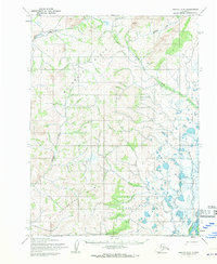
1955 Map of Noatak C-3
USGS Topo · Published 1970About this map
The Noatak River dominates the southeastern corner of this 1955 survey, where the waterway meanders through an area marked by numerous small lakes and ponds. This landscape represents a complex hydrological network where Kuchoruk Creek and Kiyak Creek drain the surrounding elevations. To the west, the Mulgrave Hills and the Alutunirok Hills provide significant topographic relief, with the Omikviorok River and Rabbit Creek cutting through the upland terrain. A localized human presence is indicated by a cluster of Cabins situated near the southern boundary, suggesting seasonal or subsistence use of the river corridor during the mid-twentieth century. The map effectively documents the unsurveyed and unmarked land lines of the Kateel River Meridian as they were predetermined by the Bureau of Land Management before extensive development.
Find a feature on this map
10 named features on this map. Tap any name to fly to it.
Don’t see what you’re looking for? This feature index may not catch every label — zoom into the map to look around manually.
Map Details
Editions of this 1955 Noatak C-3 Map
2 editions found
Other maps of this area

1951 · Noatak
USGS Topo · 1:250,000

1955 · Noatak
USGS Topo · 1:250,000

1955 · Noatak D-4
USGS Topo · 1:63,360

1955 · Noatak D-3
USGS Topo · 1:63,360

1955 · Noatak D-2
USGS Topo · 1:63,360

1955 · Noatak C-2
USGS Topo · 1:63,360

1955 · Noatak B-3
USGS Topo · 1:63,360

1955 · Noatak C-4
USGS Topo · 1:63,360

1955 · Noatak C-3
USGS Topo · 1:63,360

1955 · Noatak B-4
USGS Topo · 1:63,360