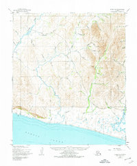
1950 Map of Nome C-2
USGS Topo · Published 1974About this map
Sinuk River and the Cripple River carve through the coastal tundra of the Seward Peninsula in this mid-century topographical study. The landscape is defined by the legacy of the gold rush, evidenced by the Sunset Mine Tailings and numerous gulches and creeks named during the prospecting era, such as Nugget Gulch and Gold Run. The small settlement of Washington sits along the Nome Teller Road, which serves as the primary artery connecting this remote territory to the regional hub.
Find a feature on this map
50 named features on this map. Tap any name to fly to it.
Don’t see what you’re looking for? This feature index may not catch every label — zoom into the map to look around manually.
Map Details
Editions of this 1950 Nome C-2 Map
3 editions found
Other maps of this area

1950 · Nome D-2
USGS Topo · 1:63,360

1950 · Nome
USGS Topo · 1:250,000

1950 · Nome B-1
USGS Topo · 1:63,360
1950 · Nome C-3
USGS Topo · 1:63,360

1950 · Nome D-1
USGS Topo · 1:63,360

1950 · Nome D-3
USGS Topo · 1:63,360

1950 · Nome C-2
USGS Topo · 1:63,360

1950 · Nome C-1
USGS Topo · 1:63,360

1951 · Nome
USGS Topo · 1:250,000

1957 · Nome
USGS Topo · 1:250,000