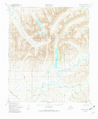
1950 Map of Nome D-2
USGS Topo · Published 1982About this map
The Kigluaik Mountains dominate this 1950s terrain on the Seward Peninsula, where the landscape is defined by its drainage basins and high-altitude lakes. Centered around the prominent Glacial Lake, the map traces the southern flow of the Sinuk (Sinrock) River as it gathers water from tributaries like American Creek and Ruby Creek. These waterways were critical for transport and prospecting long before the Nome Teller Highway provided more reliable overland access across the southern portion of the sheet.
Find a feature on this map
30 named features on this map. Tap any name to fly to it.
Don’t see what you’re looking for? This feature index may not catch every label — zoom into the map to look around manually.
Map Details
Editions of this 1950 Nome D-2 Map
3 editions found
Other maps of this area

1950 · Nome D-2
USGS Topo · 1:63,360

1950 · Nome
USGS Topo · 1:250,000

1950 · Teller
USGS Topo · 1:250,000

1950 · Teller A-2
USGS Topo · 1:63,360
1950 · Nome C-3
USGS Topo · 1:63,360

1950 · Nome D-1
USGS Topo · 1:63,360

1950 · Teller A-1
USGS Topo · 1:63,360

1950 · Nome D-3
USGS Topo · 1:63,360

1950 · Nome C-2
USGS Topo · 1:63,360

1950 · Nome C-1
USGS Topo · 1:63,360