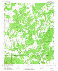
1967 Map of Non
USGS Topo · Published 1968About this map
Non serves as the central settlement hub in this 1967 survey of the borderlands between Hughes and Coal counties. The landscape is defined by a dense network of drainages, including the bifurcating paths of Boggy Creek and Caney Creek, which create a complex system of ridges and valleys across the Calvin and Stuart regions. This topography influenced the placement of local landmarks like the Non Cemetery and Rock Creek Cemetery, which occupy elevated ground above their namesake waters.
Find a feature on this map
17 named features on this map. Tap any name to fly to it.
Don’t see what you’re looking for? This feature index may not catch every label — zoom into the map to look around manually.
Map Details
Editions of this 1967 Non Map
3 editions found
Other maps of this area

1896 · Coalgate
USGS Topo · 1:125,000

1899 · Coalgate
USGS Topo · 1:125,000

1900 · Coalgate
USGS Topo · 1:125,000

1957 · Tupelo NE
USGS Topo · 1:24,000

1957 · Ardmore
USGS Topo · 1:250,000

1963 · Ardmore
USGS Topo · 1:250,000
1967 · Wardville
USGS Topo · 1:24,000

1967 · Calvin East
USGS Topo · 1:24,000
1967 · Ashland
USGS Topo · 1:24,000
1967 · Stuart
USGS Topo · 1:24,000