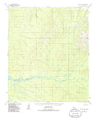
1952 Map of Nulato D-1
USGS Topo · Published 1986About this map
Whakatna Creek meanders across the southern portion of this remote Alaskan interior landscape, characterized by complex oxbows and marshy lowlands typical of the Yukon-Koyukuk region. Interpreted from 1952 aerial photography, the terrain is defined by a dense network of watercourses and elevation contours that trace the rugged drainage basins of the subarctic. To the north, Hotnakatua Creek cuts through the high ground, providing a primary drainage for the surrounding hills. This survey emphasizes the raw topography of the territory before significant modern development, focusing on the natural water systems that have historically dictated travel and subsistence patterns for those moving through the Nulato quadrangle.
Find a feature on this map
3 named features on this map. Tap any name to fly to it.
Don’t see what you’re looking for? This feature index may not catch every label — zoom into the map to look around manually.
Map Details
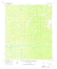
Editions of this 1952 Nulato D-1 Map
3 editions found
Other maps of this area

1945 · Nulato
USGS Topo · 1:250,000

1951 · Nulato
USGS Topo · 1:250,000

1951 · Ruby
USGS Topo · 1:250,000

1951 · Kateel River
USGS Topo · 1:250,000

1951 · Melozitna
USGS Topo · 1:250,000

1952 · Nulato C-1
USGS Topo · 1:63,360

1952 · Nulato D-1
USGS Topo · 1:63,360

1952 · Kateel River A-2
USGS Topo · 1:63,360

1952 · Ruby D-6
USGS Topo · 1:63,360

1952 · Kateel River A-1
USGS Topo · 1:63,360