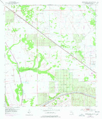
1953 Map of Okeechobee 4 SE
USGS Topo · Published 1977About this map
Allapattah Flats dominates the northern landscape of this Florida interior, showing a region defined by its water management and rail connectivity in the mid-20th century. The St Lucie Canal cuts through the southern section, marked with a project depth of 8 feet, illustrating the engineering efforts to control the Everglades' fringes. Transportation is a central theme, with the Seaboard Coast Line and Florida East Coast railroads traversing the terrain, while an Old Railroad Grade hints at earlier, perhaps bypassed, routes through the wetlands.
Find a feature on this map
15 named features on this map. Tap any name to fly to it.
Don’t see what you’re looking for? This feature index may not catch every label — zoom into the map to look around manually.
Map Details
Editions of this 1953 Okeechobee 4 SE Map
5 editions found
Other maps of this area

1953 · Okeechobee 4 SW
USGS Topo · 1:24,000

1953 · Okeechobee 4 SE
USGS Topo · 1:24,000

1953 · Okeechobee 4 NE
USGS Topo · 1:24,000

1953 · Okeechobee 4 NW
USGS Topo · 1:24,000

1953 · Indian Town NW
USGS Topo · 1:24,000

1953 · Indian Town
USGS Topo · 1:24,000

1956 · West Palm Beach
USGS Topo · 1:250,000

1956 · Fort Pierce
USGS Topo · 1:250,000

1957 · West Palm Beach
USGS Topo · 1:250,000

1958 · Fort Pierce
USGS Topo · 1:250,000