
1953 Map of Okeechobee 4 SW
USGS Topo · Published 1954About this map
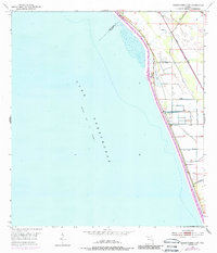
Lake Okeechobee dominates this mid-century topographic survey, showing the eastern shoreline where Martin and Palm Beach counties meet. The landscape is defined by the massive water control efforts of the era, featuring an extensive network of the Levee and several Spoil Banks designed to manage the lake's edges. Inland, the Florida East Coast rail line runs parallel to the shore, cutting through a low-lying terrain dotted with local infrastructure like a Pumping Station and several Windmills. The map captures a transitional moment in Florida's water management history, with Chaney Bay serving as a prominent indentation along a coast increasingly structured by engineering. This document provides a clear look at the early drainage and transportation corridors that shaped the agricultural and residential development of this specific stretch of the Florida coast.
Find a feature on this map
9 named features on this map. Tap any name to fly to it.
Don’t see what you’re looking for? This feature index may not catch every label — zoom into the map to look around manually.
Map Details
Editions of this 1953 Okeechobee 4 SW Map
4 editions found
Other maps of this area

1952 · Okeechobee
USGS Topo · 1:24,000

1953 · Okeechobee 4 SE
USGS Topo · 1:24,000

1953 · Okeechobee 4 NE
USGS Topo · 1:24,000

1953 · Okeechobee 4 NW
USGS Topo · 1:24,000

1956 · West Palm Beach
USGS Topo · 1:250,000

1956 · Fort Pierce
USGS Topo · 1:250,000

1957 · West Palm Beach
USGS Topo · 1:250,000

1958 · Fort Pierce
USGS Topo · 1:250,000

1958 · West Palm Beach
USGS Topo · 1:250,000

1959 · Fort Pierce
USGS Topo · 1:250,000