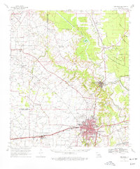
1970 Map of Opelousas
USGS Topo · Published 1977About this map
Opelousas serves as the bustling hub of this St. Landry Parish survey, anchored by its General Hospital and proximity to the St Landry Parish Airport. The landscape reveals a complex network of bayous and drainage modifications, most notably the Bayou Boeuf-Cocodrie Diversion Channel and the winding Bayou Teche. This era shows the region's heavy reliance on the oil and gas industry, with the Ville Platte Oil and Gas Field and the Thistlethwaite Oil and Gas Field prominent in the landscape. Smaller settlements like Washington, Lawtell, and Plaisance are connected by a dense lattice of state highways and three major rail lines, including the Missouri Pacific and Southern Pacific. Local history is deeply embedded in the rural countryside, evidenced by numerous country churches such as Sacred Heart Chapel and family-named cemeteries like Bertrand Cem and Pitre Cem.
Find a feature on this map
86 named features on this map. Tap any name to fly to it.
Don’t see what you’re looking for? This feature index may not catch every label — zoom into the map to look around manually.
Map Details
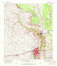
Editions of this 1970 Opelousas Map
2 editions found
Other maps of this area

1935 · Turkey Creek
USGS Topo · 1:62,500

1939 · Opelousas
USGS Topo · 1:62,500

1940 · Arnaudville
USGS Topo · 1:62,500

1947 · Ville Platte
USGS Topo · 1:31,680

1947 · Chataignier
USGS Topo · 1:31,680

1947 · Pitreville
USGS Topo · 1:31,680

1948 · Bunkie
USGS Topo · 1:62,500

1949 · Turkey Creek
USGS Topo · 1:62,500

1952 · Lake Charles
USGS Topo · 1:250,000

1954 · Lake Charles
USGS Topo · 1:250,000