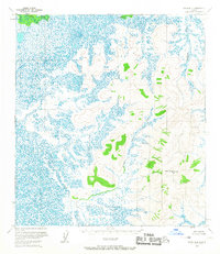
1954 Map of Ophir B-4
USGS Topo · Published 1967About this map
Old Grouch Top stands as the most prominent landmark in this interior Alaskan landscape, which was meticulously mapped from aerial photography in the early 1950s. The terrain is defined by a sharp contrast between upland peaks and an extensive network of wetlands and meandering waterways. To the north, Hammer Creek drains a sprawling marshland, while Grouch Creek carves a path through the southern reaches near the elevated terrain of Blazo and Punk. This survey by the Department of the Interior captures the area before any established road network or permanent settlements were noted, reflecting a wilderness state where land lines remained unsurveyed and unmarked by the Bureau of Land Management. The map provides a precise look at the hydrology of the Yukon-Koyukuk region, emphasizing the intricate water patterns that dominate the low-lying flats.
Find a feature on this map
6 named features on this map. Tap any name to fly to it.
Don’t see what you’re looking for? This feature index may not catch every label — zoom into the map to look around manually.
Map Details
Editions of this 1954 Ophir B-4 Map
2 editions found
Other maps of this area

1951 · Ophir
USGS Topo · 1:250,000

1954 · Ophir A-5
USGS Topo · 1:63,360

1954 · Ophir C-5
USGS Topo · 1:63,360

1954 · Ophir C-3
USGS Topo · 1:63,360

1954 · Ophir A-3
USGS Topo · 1:63,360

1954 · Ophir A-4
USGS Topo · 1:63,360

1954 · Ophir B-4
USGS Topo · 1:63,360

1954 · Ophir B-3
USGS Topo · 1:63,360

1954 · Ophir B-5
USGS Topo · 1:63,360

1954 · Ophir C-4
USGS Topo · 1:63,360