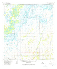
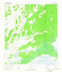
1954 Map of Ophir C-2
USGS Topo · Published 1978About this map
The Innoko River winds through this interior Alaskan landscape, characterized by complex oxbows and a vast network of marshes and wetlands. Surveyed in the mid-1950s, the terrain reveals a primitive transportation network where a Tractor Trail provides one of the few overland routes through the wilderness south of Finland Creek. The naming of local waterways like Scandinavian Creek and Doctor Beaver Creek suggests a history of early 20th-century exploration and perhaps the influence of localized trapping or prospecting camps in the Yukon-Koyukuk region.
Find a feature on this map
11 named features on this map. Tap any name to fly to it.
Don’t see what you’re looking for? This feature index may not catch every label — zoom into the map to look around manually.
Map Details
Editions of this 1954 Ophir C-2 Map
3 editions found
Other maps of this area

1951 · Ophir
USGS Topo · 1:250,000
1954 · Ophir D-1
USGS Topo · 1:63,360

1954 · Ophir C-3
USGS Topo · 1:63,360

1954 · Ophir C-1
USGS Topo · 1:63,360
1954 · Ophir D-3
USGS Topo · 1:63,360

1954 · Ophir C-2
USGS Topo · 1:63,360

1954 · Ophir B-1
USGS Topo · 1:63,360

1954 · Ophir B-2
USGS Topo · 1:63,360

1954 · Ophir B-3
USGS Topo · 1:63,360
1954 · Ophir D-2
USGS Topo · 1:63,360