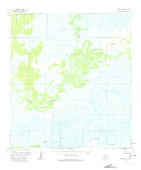
1954 Map of Ophir C-4
USGS Topo · Published 1975About this map
The Innoko River dominates this mid-century Alaskan landscape, its winding course forming intricate oxbows and meanders through a vast expanse of wetlands and unsurveyed land. Surveyed in the early 1950s using photogrammetric methods, the map captures the wilderness character of the region where the Mud River joins the main waterway. To the northeast, the Wapoo Hills provide the primary topographic relief in an otherwise low-lying basin. Human presence is sparse, indicated only by isolated Cabins along the riverbanks, suggesting seasonal use by trappers or hunters rather than permanent settlement. The southern portion of the quadrangle is defined by the headwaters of Hammer Creek, which drains a complex system of unnamed swamps and ponds. This survey provides a rare look at the interior before modern digital mapping, reflecting the period when the Bureau of Land Management was still determining land lines for this unsurveyed territory.
Find a feature on this map
5 named features on this map. Tap any name to fly to it.
Don’t see what you’re looking for? This feature index may not catch every label — zoom into the map to look around manually.
Map Details
Editions of this 1954 Ophir C-4 Map
2 editions found
Other maps of this area

1951 · Ophir
USGS Topo · 1:250,000
1954 · Ophir D-4
USGS Topo · 1:63,360
1954 · Ophir D-5
USGS Topo · 1:63,360

1954 · Ophir C-5
USGS Topo · 1:63,360

1954 · Ophir C-3
USGS Topo · 1:63,360

1954 · Ophir B-4
USGS Topo · 1:63,360
1954 · Ophir D-3
USGS Topo · 1:63,360

1954 · Ophir B-3
USGS Topo · 1:63,360

1954 · Ophir B-5
USGS Topo · 1:63,360

1954 · Ophir C-4
USGS Topo · 1:63,360