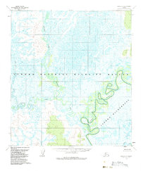
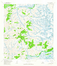
1954 Map of Ophir C-5
USGS Topo · Published 1983About this map
The Innoko River winds through this interior Alaskan landscape, defining a complex network of wetlands and oxbow lakes captured in 1954. This remote terrain is primarily managed as the Innoko National Wildlife Refuge, with large portions designated as the Innoko Wilderness. The drainage patterns are dominated by slow-moving water bodies like Magitchlie Creek and the North Fork Hather Creek, which feed into the main river channel. The topographic data, derived from 1953 aerial photography, reveals a landscape devoid of permanent roads or settlements during the mid-century period. Gray land lines on the sheet indicate unsurveyed and unmarked locations predetermined by the Bureau of Land Management, highlighting the navigational challenges of this interior region before modern infrastructure.
Find a feature on this map
6 named features on this map. Tap any name to fly to it.
Don’t see what you’re looking for? This feature index may not catch every label — zoom into the map to look around manually.
Map Details
Editions of this 1954 Ophir C-5 Map
2 editions found
Other maps of this area

1951 · Ophir
USGS Topo · 1:250,000
1954 · Ophir D-6
USGS Topo · 1:63,360

1954 · Ophir C-6
USGS Topo · 1:63,360
1954 · Ophir D-4
USGS Topo · 1:63,360
1954 · Ophir D-5
USGS Topo · 1:63,360

1954 · Ophir C-5
USGS Topo · 1:63,360

1954 · Ophir B-4
USGS Topo · 1:63,360
1954 · Ophir B-6
USGS Topo · 1:63,360

1954 · Ophir B-5
USGS Topo · 1:63,360

1954 · Ophir C-4
USGS Topo · 1:63,360