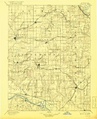
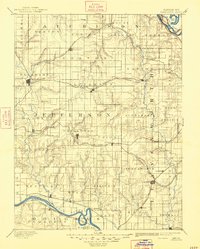
1894 Map of Oskaloosa
USGS Topo · Published 1918About this map
Oskaloosa serves as a central hub for Jefferson County in this late-nineteenth-century landscape, which is defined by a dense network of steam-era rail lines and river valleys. The Kansas River and the Wakarusa River snake across the southern boundary, while the Missouri River cuts through the northeast corner near Bean Lake. This era shows the dominance of the Atchison Topeka and Santa Fe Railroad and the Union Pacific Railroad, which facilitated the growth of shipping points like Mc Louth and Valley Falls. Local topography is detailed through landmarks like Jarbalo Mound and the winding course of Grasshopper Creek. The map documents a period when small agricultural settlements like Medina, Ozawkie, and Easton were connected primarily by these rails and the creeks that carve through the surrounding townships.
Find a feature on this map
83 named features on this map. Tap any name to fly to it.
Don’t see what you’re looking for? This feature index may not catch every label — zoom into the map to look around manually.
Map Details
Editions of this 1894 Oskaloosa Map
6 editions found

Other maps of this area

1885 · Atchison
USGS Topo · 1:125,000

1885 · Lawrence
USGS Topo · 1:125,000

1886 · Oskaloosa
USGS Topo · 1:125,000

1887 · Olathe
USGS Topo · 1:125,000

1888 · Oskaloosa
USGS Topo · 1:125,000

1888 · Atchison
USGS Topo · 1:125,000

1888 · Hiawatha
USGS Topo · 1:125,000

1889 · Burlingame
USGS Topo · 1:125,000

1889 · Topeka
USGS Topo · 1:125,000

1889 · Lawrence
USGS Topo · 1:125,000