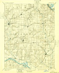
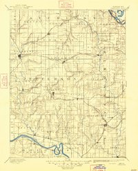
1894 Map of Oskaloosa
USGS Topo · Published 1932About this map
The Kansas River winds through the southern reaches of this Northeast Kansas landscape, where surveyors Henry Gannett and A.H. Thompson documented a region transitioning into a dense network of agricultural townships and rail corridors. Centered on Oskaloosa, the county seat, the map reveals a land defined by its drainages, with Stranger Creek and Delaware River cutting north-to-south through Jefferson County. The era's transportation boom is evident in the convergence of four major rail lines, including the Atchison Topeka and Santa Fe Railroad and the Union Pacific Railroad, which serviced established settlements like Nortonville, Winchester, and Tonganoxie. To the northeast, the Missouri River forms a natural border, while isolated landmarks such as Jarbato Mound rise above the surrounding creeks and ridges, providing a clear picture of the topography before modern development altered the rural character of the Missouri-Kansas borderlands.
Find a feature on this map
86 named features on this map. Tap any name to fly to it.
Don’t see what you’re looking for? This feature index may not catch every label — zoom into the map to look around manually.
Map Details
Editions of this 1894 Oskaloosa Map
6 editions found

Other maps of this area

1885 · Atchison
USGS Topo · 1:125,000

1885 · Lawrence
USGS Topo · 1:125,000

1886 · Oskaloosa
USGS Topo · 1:125,000

1887 · Olathe
USGS Topo · 1:125,000

1888 · Oskaloosa
USGS Topo · 1:125,000

1888 · Atchison
USGS Topo · 1:125,000

1888 · Hiawatha
USGS Topo · 1:125,000

1889 · Burlingame
USGS Topo · 1:125,000

1889 · Topeka
USGS Topo · 1:125,000

1889 · Lawrence
USGS Topo · 1:125,000