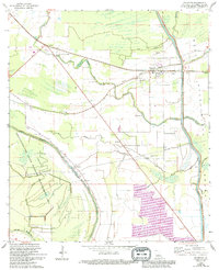
1968 Map of Palmetto
USGS Topo · Published 1994About this map
Atchafalaya Floodway dominates the eastern edge of this St. Landry Parish landscape, where the Glaises Diversion Channel and a significant Levee system manage the water of the basin. The map reveals a transition from the agricultural plains of the Prairie to the dense, low-lying wetlands of the Thistlethwaite State Wildlife Management Area. Settlements like Palmetto, Lebeau, and the Rideau Settlement are clustered along the high ground near natural waterways such as Negro Foot Bayou and Wauksha Bayou.
Find a feature on this map
43 named features on this map. Tap any name to fly to it.
Don’t see what you’re looking for? This feature index may not catch every label — zoom into the map to look around manually.
Map Details
Editions of this 1968 Palmetto Map
3 editions found
Other maps of this area

1939 · Opelousas
USGS Topo · 1:62,500

1948 · Bunkie
USGS Topo · 1:62,500

1952 · Lake Charles
USGS Topo · 1:250,000

1954 · Lake Charles
USGS Topo · 1:250,000

1954 · Baton Rouge
USGS Topo · 1:250,000

1955 · Odenburg
USGS Topo · 1:62,500

1956 · Opelousas
USGS Topo · 1:62,500

1956 · Baton Rouge
USGS Topo · 1:250,000

1957 · Opelousas
USGS Topo · 1:62,500

1959 · Palmetto
USGS Topo · 1:62,500