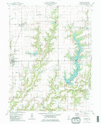
1979 Map of Palmyra
USGS Topo · Published 1980About this map
Modesto and Palmyra anchor this Macoupin County landscape during the late 1970s, a period defined by the sprawling waters of Otter Lake and the smaller Lake Greenwood. The terrain is deeply partitioned by drainage networks like Nassa Creek and the East Fork of Otter Creek, which carved the valleys now filled by these reservoirs. Rural life is evidenced by a dense network of community landmarks, including Holy Rosary Ch, Blooming Grove Ch, and Pleasant View Ch. Transportation history is visible through the Old Railroad Grade passing through Modesto, while the era's modern infrastructure is represented by the Zelmer Memorial Airport and several private landing strips like the Weber Landing Strip. The map also captures numerous family-linked sites, including the Etter Cem and Cloud Cem, essential for genealogical research in North and South Palmyra townships.
Find a feature on this map
42 named features on this map. Tap any name to fly to it.
Don’t see what you’re looking for? This feature index may not catch every label — zoom into the map to look around manually.
Map Details
Editions of this 1979 Palmyra Map
2 editions found
Other maps of this area

1923 · Carlinville
USGS Topo · 1:48,000

1924 · Waverly
USGS Topo · 1:62,500

1925 · Carlinville
USGS Topo · 1:62,500

1926 · Waverly
USGS Topo · 1:62,500

1931 · Carlinville
USGS Topo · 1:62,500

1932 · Greenfield
USGS Topo · 1:62,500

1932 · Jacksonville
USGS Topo · 1:62,500

1937 · Jacksonville
USGS Topo · 1:62,500

1948 · Quincy
USGS Topo · 1:250,000

1956 · Quincy
USGS Topo · 1:250,000