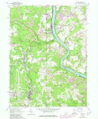
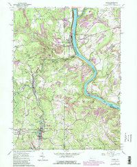
1963 Map of Parker
USGS Topo · Published 1980About this map
The Allegheny River carves a deep path through the northern coal and oil country of western Pennsylvania, where the borders of Butler, Armstrong, and Clarion counties converge. This landscape is defined by the heavy footprint of extractive industry, featuring numerous strip mines and oil wells that dot the uplands. Settlements like Petrolia, Parker, and West Monterey are clustered near the river and rail lines, including the Baltimore and Ohio and Conrail networks.
Find a feature on this map
57 named features on this map. Tap any name to fly to it.
Don’t see what you’re looking for? This feature index may not catch every label — zoom into the map to look around manually.
Map Details
Editions of this 1963 Parker Map
5 editions found
Other maps of this area

1900 · Kittanning
USGS Topo · 1:62,500

1902 · Kittanning
USGS Topo · 1:62,500

1907 · Foxburg
USGS Topo · 1:62,500

1908 · Foxburg
USGS Topo · 1:62,500

1909 · Butler
USGS Topo · 1:62,500

1910 · Hilliards
USGS Topo · 1:62,500

1911 · Butler
USGS Topo · 1:62,500

1912 · Hilliards
USGS Topo · 1:62,500

1944 · Hilliards
USGS Topo · 1:62,500

1953 · Pittsburgh
USGS Topo · 1:250,000