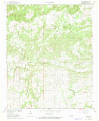
1967 Map of Parker
USGS Topo · Published 1968About this map
Muddy Boggy Creek and its many tributaries, including Caney Boggy Creek and Sweetwater Creek, dominate this central Oklahoma landscape within Jackson and Haskell townships. The topography is defined by the complex drainage patterns of these winding waterways, which converge and branch across the terrain. The small community of Parker serves as a local landmark in the northern portion of the quadrangle.
Find a feature on this map
14 named features on this map. Tap any name to fly to it.
Don’t see what you’re looking for? This feature index may not catch every label — zoom into the map to look around manually.
Map Details
Editions of this 1967 Parker Map
2 editions found
Other maps of this area

1896 · Coalgate
USGS Topo · 1:125,000

1899 · Coalgate
USGS Topo · 1:125,000

1900 · Coalgate
USGS Topo · 1:125,000

1957 · Coalgate
USGS Topo · 1:24,000

1957 · Coalgate SE
USGS Topo · 1:24,000

1957 · Centrahoma
USGS Topo · 1:24,000

1957 · Tupelo NE
USGS Topo · 1:24,000

1957 · Ardmore
USGS Topo · 1:250,000

1963 · Ardmore
USGS Topo · 1:250,000
1967 · Wardville
USGS Topo · 1:24,000