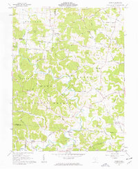
1961 Map of Patriot
USGS Topo · Published 1963About this map
Symmes Creek winds through the heart of the Wayne National Forest on this early 1960s survey, illustrating the deeply carved landscape of southern Ohio. Small rural communities like Patriot, Cadmus, and Rio Grande are connected by a network of winding roads, including the historic Trace. The map captures a transition period where family-run farms and remote homesteads remained the primary character of the region.
Find a feature on this map
58 named features on this map. Tap any name to fly to it.
Don’t see what you’re looking for? This feature index may not catch every label — zoom into the map to look around manually.
Map Details
Editions of this 1961 Patriot Map
3 editions found
Other maps of this area

1898 · Ironton
USGS Topo · 1:62,500

1900 · Ironton
USGS Topo · 1:62,500

1906 · Bidwell
USGS Topo · 1:62,500

1906 · Athalia
USGS Topo · 1:62,500

1908 · Bidwell
USGS Topo · 1:62,500

1908 · Athalia
USGS Topo · 1:62,500

1912 · Oak Hill
USGS Topo · 1:62,500

1957 · Huntington
USGS Topo · 1:250,000

1960 · Huntington
USGS Topo · 1:250,000
1961 · Oak Hill
USGS Topo · 1:24,000