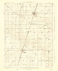
1927 Map of Paxton
USGS Topo · Published 1927About this map
The Paxton and Rantoul corridor in the late 1920s showcases a landscape defined by the transition from early rural aviation to established prairie agriculture. A standout feature is the Chanute Flying Field south of Rantoul, which reflects the growing military aviation presence in the region during this era. The map reveals an intricate network of local education, with dozens of family-named schools such as Lily Dell School, Kemp School, and Strayer School dotting the countryside, serving the farming communities of Wall, Patton, and Rantoul townships.
Find a feature on this map
73 named features on this map. Tap any name to fly to it.
Don’t see what you’re looking for? This feature index may not catch every label — zoom into the map to look around manually.
Map Details
Editions of this 1927 Paxton Map
2 editions found
Other maps of this area

1906 · Urbana
USGS Topo · 1:62,500

1907 · Mahomet
USGS Topo · 1:62,500

1924 · Paxton
USGS Topo · 1:62,500

1927 · Paxton
USGS Topo · 1:62,500

1928 · Gibson City
USGS Topo · 1:62,500

1931 · Fithian
USGS Topo · 1:48,000

1936 · Potomac
USGS Topo · 1:62,500

1939 · Cissna Park
USGS Topo · 1:62,500

1943 · Fithian
USGS Topo · 1:62,500

1947 · Sibley
USGS Topo · 1:62,500