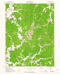
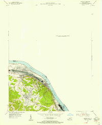
1961 Map of Pedro
USGS Topo · Published 1963About this map
Industrial ruins and deep extraction pits define the rugged landscape within the Wayne National Forest in the early 1960s. The region's historical reliance on heavy industry is evident at the Buckhorn Furnace and Lawrence Furnace, which stand as remnants of a former iron-smelting era. These sites are linked by the Detroit Toledo and Ironton RR, which winds through the hollows to serve settlements like Superior, Pedro, and Lisman.
Find a feature on this map
86 named features on this map. Tap any name to fly to it.
Don’t see what you’re looking for? This feature index may not catch every label — zoom into the map to look around manually.
Map Details
Editions of this 1961 Pedro Map
4 editions found
Other maps of this area

1898 · Ironton
USGS Topo · 1:62,500

1900 · Ironton
USGS Topo · 1:62,500

1911 · Sciotoville
USGS Topo · 1:62,500

1912 · Oak Hill
USGS Topo · 1:62,500

1913 · Sciotoville
USGS Topo · 1:62,500

1926 · Greenup
USGS Topo · 1:48,000

1930 · Greenup
USGS Topo · 1:62,500

1953 · Greenup
USGS Topo · 1:24,000
1953 · Ironton
USGS Topo · 1:24,000

1957 · Huntington
USGS Topo · 1:250,000