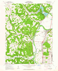
1961 Map of Piketon
USGS Topo · Published 1963About this map
The Scioto River valley dominates this early 1960s landscape, illustrating the transition from 19th-century infrastructure to the nuclear age. Traces of the Ohio and Erie Canal (Abandoned) run parallel to the river and the Norfolk and Western railroad, marking a historical corridor that once defined Pike County commerce. In the southeast, the massive U S Reservation Atomic Energy Commission stands as a significant Cold War-era presence near the community of Sargents.
Find a feature on this map
76 named features on this map. Tap any name to fly to it.
Don’t see what you’re looking for? This feature index may not catch every label — zoom into the map to look around manually.
Map Details
Editions of this 1961 Piketon Map
4 editions found
Other maps of this area

1906 · Waverly
USGS Topo · 1:62,500

1908 · Waverly
USGS Topo · 1:62,500

1911 · Sciotoville
USGS Topo · 1:62,500

1913 · Sciotoville
USGS Topo · 1:62,500

1915 · Otway
USGS Topo · 1:62,500

1915 · Piketon
USGS Topo · 1:62,500

1917 · Piketon
USGS Topo · 1:62,500

1917 · Otway
USGS Topo · 1:62,500

1944 · Piketon
USGS Topo · 1:62,500

1947 · Columbus
USGS Topo · 1:250,000