
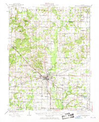
1924 Map of Pinckneyville
USGS Topo · Published 1958About this map
Pinckneyville serves as the busy crossroads of Perry County on this 1920s survey, where the Illinois Central and the Mississippi River and Bonne Terre railroads intersect. This era was defined by the region's burgeoning coal industry, evidenced by operations like the Panther Mine, Victory Coal Mine, and Jewel Mine No 2 southeast of town. The landscape is dotted with a remarkably dense network of rural schoolhouses, from Laney School in the north to Osborne School near the southern border, reflecting a localized educational system before the consolidation of rural districts.
Find a feature on this map
67 named features on this map. Tap any name to fly to it.
Don’t see what you’re looking for? This feature index may not catch every label — zoom into the map to look around manually.
Map Details
Editions of this 1924 Pinckneyville Map
2 editions found
Other maps of this area

1910 · Herrin
USGS Topo · 1:62,500

1910 · Murphysboro
USGS Topo · 1:62,500

1910 · Okawville
USGS Topo · 1:62,500

1914 · Coulterville
USGS Topo · 1:62,500

1916 · Campbell Hill
USGS Topo · 1:62,500

1917 · Coulterville
USGS Topo · 1:62,500

1918 · Campbell Hill
USGS Topo · 1:62,500

1926 · Pinckneyville
USGS Topo · 1:62,500

1926 · Duquoin
USGS Topo · 1:62,500

1931 · Hoyleton
USGS Topo · 1:48,000