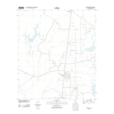
2012 Map of Pine Prairie
USGS Topo · Published 2012About this map
Pine Prairie serves as the central hub of this Evangeline Parish landscape, where a grid of residential streets like Fig St and Mulberry St meet the rural corridors of Louisiana. The area is defined by its complex drainage network, where Boggy Bayou and Carps Bayou wind through the terrain alongside the sprawling waters of Crooked Creek Reservoir and Millers Lake. For those tracing local families, the map is remarkably detailed with burial sites, including Saint Peters Cem, Ardoin Cem, and Fontenot Cem near the southern settlement of Easton. Further north, the community of Turkey Creek sits near the headwaters of the bayous, while industrial elements like Oil Field Rd point to the parish’s connection to regional resource extraction.
Find a feature on this map
83 named features on this map. Tap any name to fly to it.
Don’t see what you’re looking for? This feature index may not catch every label — zoom into the map to look around manually.
Map Details
Editions of this 2012 Pine Prairie Map
This is the sole edition of this map. No revisions or reprints were ever made.
Other maps of this area

1935 · Beaver
USGS Topo · 1:31,680

1935 · Turkey Creek
USGS Topo · 1:62,500

1942 · Oakdale
USGS Topo · 1:62,500

1947 · Ville Platte
USGS Topo · 1:31,680

1947 · Bond
USGS Topo · 1:31,680

1949 · Glenmora
USGS Topo · 1:31,680

1949 · Turkey Creek
USGS Topo · 1:62,500

1952 · Lake Charles
USGS Topo · 1:250,000
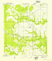
1954 · Beaver
USGS Topo · 1:31,680

1954 · Lake Charles
USGS Topo · 1:250,000