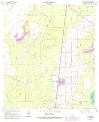
1967 Map of Pine Prairie
USGS Topo · Published 1993About this map
The Pine Prairie Oil Field anchors the southern portion of this Evangeline Parish landscape, signaling the industrial character of the region during the late 1960s. The village of Pine Prairie serves as the central hub, surrounded by a dense network of family and community landmarks such as St Peters Cem, Ardoin Cem, and Friendship Ch. These sites provide significant data for genealogical research, identifying legacy family names tied to the local land.
Find a feature on this map
25 named features on this map. Tap any name to fly to it.
Don’t see what you’re looking for? This feature index may not catch every label — zoom into the map to look around manually.
Map Details
Editions of this 1967 Pine Prairie Map
This is the sole edition of this map. No revisions or reprints were ever made.
Other maps of this area

1935 · Beaver
USGS Topo · 1:31,680

1935 · Turkey Creek
USGS Topo · 1:62,500

1942 · Oakdale
USGS Topo · 1:62,500

1947 · Ville Platte
USGS Topo · 1:31,680

1947 · Bond
USGS Topo · 1:31,680

1949 · Glenmora
USGS Topo · 1:31,680

1949 · Turkey Creek
USGS Topo · 1:62,500

1952 · Lake Charles
USGS Topo · 1:250,000
1954 · Beaver
USGS Topo · 1:31,680

1954 · Lake Charles
USGS Topo · 1:250,000