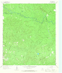
1963 Map of Pluck
USGS Topo · Published 1966About this map
The Neches River forms a wide, meandering boundary in this portion of East Texas, defining a landscape marked by dense sloughs and seasonal waterways. Near the settlement of Pluck, the terrain is crisscrossed by an Old Railroad Grade, reflecting the importance of historical timber or freight transport through the bottomlands. The map reveals a transition from the river's wetland features like Cypress Lake and Lamar Slough to higher ground where family-named sites such as Grimes Cem and Stryker Cem are situated. Numerous drainage features like Piney Creek and Sulphur Creek suggest a highly saturated environment, where small local landmarks like Georges Prairie Pond and Harris Spring provide specific points of interest for local historians studying the rural settlement patterns of the mid-1960s.
Find a feature on this map
32 named features on this map. Tap any name to fly to it.
Don’t see what you’re looking for? This feature index may not catch every label — zoom into the map to look around manually.
Map Details
Editions of this 1963 Pluck Map
2 editions found
Other maps of this area

1927 · Lufkin 4-c
USGS Topo · 1:24,000

1928 · Lufkin 4-d
USGS Topo · 1:24,000

1932 · Manning
USGS Topo · 1:62,500

1953 · Palestine
USGS Topo · 1:250,000

1954 · Beaumont
USGS Topo · 1:250,000

1955 · Camden
USGS Topo · 1:62,500

1955 · New Willard
USGS Topo · 1:62,500

1957 · Beaumont
USGS Topo · 1:250,000

1957 · Palestine
USGS Topo · 1:250,000
1963 · Manning
USGS Topo · 1:24,000