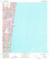
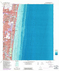
1962 Map of Pompano Beach
USGS Topo · Published 1983About this map
Pompano Beach Airpark and the extensive network of the Intracoastal Waterway define the coastal geography of Broward County during this era of rapid residential development. The map shows the intricate finger canals and private docks that transformed the shoreline, creating communities like Cypress Isles Estates, Santa Barbara Shores, and Sea Ranch Lakes. These mid-century waterway subdivisions reflect the post-war boom that reshaped the Florida coast into a dense suburban landscape, bounded by the Atlantic Ocean and organized around new leisure hubs like the Coral Ridge Country Club.
Find a feature on this map
75 named features on this map. Tap any name to fly to it.
Don’t see what you’re looking for? This feature index may not catch every label — zoom into the map to look around manually.
Map Details
Editions of this 1962 Pompano Beach Map
5 editions found
Other maps of this area

1945 · Fort Lauderdale North
USGS Topo · 1:24,000

1946 · West Dixie Bend
USGS Topo · 1:24,000

1946 · Boca Raton
USGS Topo · 1:24,000

1949 · Fort Lauderdale North
USGS Topo · 1:24,000

1949 · West Dixie Bend
USGS Topo · 1:24,000

1949 · Port Everglades
USGS Topo · 1:24,000

1949 · Fort Lauderdale South
USGS Topo · 1:24,000

1949 · Pompano Beach
USGS Topo · 1:24,000

1950 · Boca Raton
USGS Topo · 1:24,000

1956 · West Palm Beach
USGS Topo · 1:250,000
Featured Places
- Fort Lauderdale, FL
- Pompano Beach, FL
- Lauderdale-by-the-Sea, FL
- Birch Ocean Front, Fort Lauderdale
- Sunrise Key, Fort Lauderdale