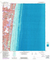
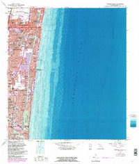
1962 Map of Pompano Beach
USGS Topo · Published 1986About this map
Pompano Beach and Fort Lauderdale characterize this mid-century look at the Gold Coast during its postwar residential boom. The map illustrates a landscape transformed by dredging and filling, creating intricate canal systems for neighborhoods like Garden Isles, Cypress Harbor, and Coral Ridge Isles. This development pattern, defined by finger piers and artificial waterways, highlights the era's focus on waterfront living between the Intracoastal Waterway and the Atlantic Ocean.
Find a feature on this map
70 named features on this map. Tap any name to fly to it.
Don’t see what you’re looking for? This feature index may not catch every label — zoom into the map to look around manually.
Map Details
Editions of this 1962 Pompano Beach Map
5 editions found
Other maps of this area

1945 · Fort Lauderdale North
USGS Topo · 1:24,000

1946 · West Dixie Bend
USGS Topo · 1:24,000

1946 · Boca Raton
USGS Topo · 1:24,000

1949 · Fort Lauderdale North
USGS Topo · 1:24,000

1949 · West Dixie Bend
USGS Topo · 1:24,000

1949 · Port Everglades
USGS Topo · 1:24,000

1949 · Fort Lauderdale South
USGS Topo · 1:24,000

1949 · Pompano Beach
USGS Topo · 1:24,000

1950 · Boca Raton
USGS Topo · 1:24,000

1956 · West Palm Beach
USGS Topo · 1:250,000
Featured Places
- Fort Lauderdale, FL
- Pompano Beach, FL
- Lauderdale-by-the-Sea, FL
- Birch Ocean Front, Fort Lauderdale
- Sunrise Key, Fort Lauderdale