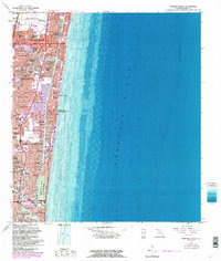
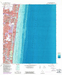
1962 Map of Pompano Beach
USGS Topo · Published 1986About this map
Pompano Beach and Fort Lauderdale dominate this mid-century coastal survey, reflecting the rapid residential expansion of Broward County during the post-war era. The landscape is defined by the intricate finger-canal developments that characterize the region's inland waterways, including neighborhoods like Garden Isles, Santa Barbara Shores, and Coral Ridge Isles. Between the mainland and the Atlantic Ocean, the Intracoastal Waterway serves as a central artery for the burgeoning coastal communities of Sea Ranch Lakes and Lauderdale-by-the-Sea.
Find a feature on this map
68 named features on this map. Tap any name to fly to it.
Don’t see what you’re looking for? This feature index may not catch every label — zoom into the map to look around manually.
Map Details
Editions of this 1962 Pompano Beach Map
5 editions found
Other maps of this area

1945 · Fort Lauderdale North
USGS Topo · 1:24,000

1946 · West Dixie Bend
USGS Topo · 1:24,000

1946 · Boca Raton
USGS Topo · 1:24,000

1949 · Fort Lauderdale North
USGS Topo · 1:24,000

1949 · West Dixie Bend
USGS Topo · 1:24,000

1949 · Port Everglades
USGS Topo · 1:24,000

1949 · Fort Lauderdale South
USGS Topo · 1:24,000

1949 · Pompano Beach
USGS Topo · 1:24,000

1950 · Boca Raton
USGS Topo · 1:24,000

1956 · West Palm Beach
USGS Topo · 1:250,000
Featured Places
- Fort Lauderdale, FL
- Pompano Beach, FL
- Lauderdale-by-the-Sea, FL
- Birch Ocean Front, Fort Lauderdale
- Sunrise Key, Fort Lauderdale