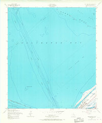
1954 Map of Port Bolivar
USGS Topo · Published 1968About this map
Galveston Bay serves as the central focus of this mid-century hydrographic study, capturing the maritime infrastructure essential to the region's shipping economy. The Houston Ship Channel cuts a precise path through the bay, while the Intracoastal Waterway skirts the inner edge of the Bolivar Peninsula. At the tip of the peninsula, the settlement of Port Bolivar is documented alongside small coastal features like Horseshoe Lake and Oyster Lake.
Find a feature on this map
20 named features on this map. Tap any name to fly to it.
Don’t see what you’re looking for? This feature index may not catch every label — zoom into the map to look around manually.
Map Details
Editions of this 1954 Port Bolivar Map
4 editions found
Other maps of this area

1929 · Virginia Point
USGS Topo · 1:24,000

1929 · Texas City
USGS Topo · 1:24,000

1930 · Galveston
USGS Topo · 1:24,000

1931 · Flake
USGS Topo · 1:24,000

1932 · Clifton By The Sea
USGS Topo · 1:31,680

1932 · Texas City
USGS Topo · 1:31,680

1932 · Bolivar Point
USGS Topo · 1:24,000

1932 · Virginia Point
USGS Topo · 1:31,680

1933 · The Jetties
USGS Topo · 1:31,680

1933 · Whites Lake
USGS Topo · 1:31,680