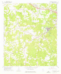
1964 Map of Porterdale
USGS Topo · Published 1976About this map
Porterdale and the surrounding Newton County countryside are defined by the winding course of the Yellow River as it flows past Cedar Shoals. This mid-century survey captures a landscape of transition, where the industrial presence of the Central of Georgia railroad and the growing street grid of Covington meet a deeply established rural network. The map preserves the locations of numerous community anchors, including the Salem Campground and schools like Livingston Sch and Cousins High Sch.
Find a feature on this map
66 named features on this map. Tap any name to fly to it.
Don’t see what you’re looking for? This feature index may not catch every label — zoom into the map to look around manually.
Map Details
Editions of this 1964 Porterdale Map
4 editions found

Other maps of this area

1888 · Atlanta
USGS Topo · 1:125,000

1890 · Atlanta
USGS Topo · 1:125,000

1892 · Atlanta
USGS Topo · 1:125,000

1895 · Atlanta
USGS Topo · 1:125,000

1896 · Monroe
USGS Topo · 1:125,000

1953 · Atlanta
USGS Topo · 1:250,000

1953 · Athens
USGS Topo · 1:250,000

1956 · Conyers
USGS Topo · 1:24,000

1957 · Atlanta
USGS Topo · 1:250,000

1958 · Athens
USGS Topo · 1:250,000