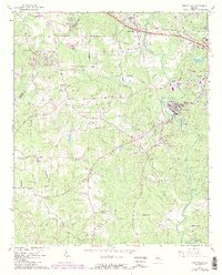
1964 Map of Porterdale
USGS Topo · Published 1986About this map
Porterdale and the western outskirts of Covington are the primary focal points of this mid-century portrait of Newton County. The Yellow River winds through the landscape, marked by natural features like Cedar Shoals and Langston Shoals, which helped shape the early industrial and agricultural development of the region. Transportation networks are well-defined, showing the paths of the Central of Georgia and Georgia railroads alongside the emerging Interchange 44 on the Interstate highway system.
Find a feature on this map
63 named features on this map. Tap any name to fly to it.
Don’t see what you’re looking for? This feature index may not catch every label — zoom into the map to look around manually.
Map Details
Editions of this 1964 Porterdale Map
4 editions found

Other maps of this area

1888 · Atlanta
USGS Topo · 1:125,000

1890 · Atlanta
USGS Topo · 1:125,000

1892 · Atlanta
USGS Topo · 1:125,000

1895 · Atlanta
USGS Topo · 1:125,000

1896 · Monroe
USGS Topo · 1:125,000

1953 · Atlanta
USGS Topo · 1:250,000

1953 · Athens
USGS Topo · 1:250,000

1956 · Conyers
USGS Topo · 1:24,000

1957 · Atlanta
USGS Topo · 1:250,000

1958 · Athens
USGS Topo · 1:250,000