
1935 Map of Powhatan
USGS Topo · Published 1935About this map
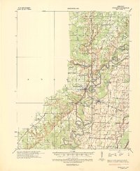
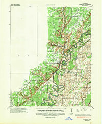
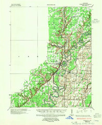
The Black River and Spring River converge in this mid-1930s landscape, defining the transition between the Ozark foothills and the Mississippi Alluvial Plain. The historic river town of Powhatan sits prominently near the confluence, serving as a focal point alongside Black Rock and Portia. The transportation network of the era is remarkably detailed, showing the St Louis San Francisco Railroad crossing the rivers and various river crossings like Gibson Ferry and Scotts Ferry still in use before modern bridging. For genealogists, the map is a dense record of rural social centers, documenting combined institutions such as Fairview Sch & Cem and Lauderdale Ch Sch & Cem. The varied terrain includes the prominent Escarpment rising above the bottomlands, where numerous oxbows like Horseshoe Lake and Round Lake reveal the changing path of the rivers over time.
Find a feature on this map
68 named features on this map. Tap any name to fly to it.
Don’t see what you’re looking for? This feature index may not catch every label — zoom into the map to look around manually.
Map Details
Editions of this 1935 Powhatan Map
4 editions found
Other maps of this area

1932 · Strawberry
USGS Topo · 1:62,500

1932 · Walnut Ridge
USGS Topo · 1:62,500

1934 · Powhatan
USGS Topo · 1:62,500

1935 · Sedgwick
USGS Topo · 1:62,500

1935 · Alicia
USGS Topo · 1:62,500

1935 · Strawberry
USGS Topo · 1:62,500

1935 · Reyno
USGS Topo · 1:62,500

1935 · Walnut Ridge
USGS Topo · 1:62,500

1941 · Strawberry
USGS Topo · 1:62,500

1953 · Memphis
USGS Topo · 1:250,000