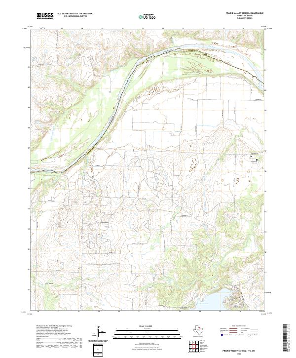
2022 Map of Prairie Valley School
USGS Topo · Published 2022About this map
The Red River defines the winding border between Texas and Oklahoma in this northern Montague County landscape. The survey captures a transition from the riparian lowlands of the Old Channel Red River to the upland plains where local history is preserved at the Old Spanish Fork Cem and New Spanish Fort Cem. To the south, the terrain descends toward the modern shoreline of Lake Nocona, fed by drainage from Farmers Cr and Red Br. This 2022 dataset provides a clear view of the rural road network, showing family-named routes like Russell Rd and Bonnie Mitchell Rd that connect isolated properties and ranch lands. Notable geological features like Wolf Hollow and multiple tributary crossings, including Maddox Cr and Village Cr, illustrate the complex hydrology of the Red River valley floor before it meets the reservoir.
Find a feature on this map
50 named features on this map. Tap any name to fly to it.
Don’t see what you’re looking for? This feature index may not catch every label — zoom into the map to look around manually.
Map Details
Editions of this 2022 Prairie Valley School Map
This is the sole edition of this map. No revisions or reprints were ever made.
Other maps of this area

1901 · Addington
USGS Topo · 1:125,000

1905 · Montague
USGS Topo · 1:125,000

1954 · Sherman
USGS Topo · 1:250,000

1957 · Ardmore
USGS Topo · 1:250,000

1958 · Sherman
USGS Topo · 1:250,000

1962 · Ryan
USGS Topo · 1:62,500

1963 · Ardmore
USGS Topo · 1:250,000
1968 · Bonita
USGS Topo · 1:24,000
1968 · Spanish Fort
USGS Topo · 1:24,000

1968 · Nocona
USGS Topo · 1:24,000