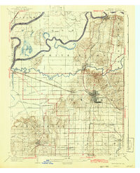
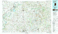
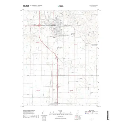
1903 Map of Princeton
USGS Topo · Published 1922About this map
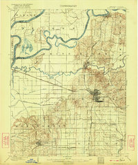
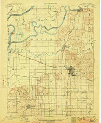
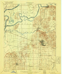
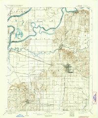
The Wabash River and White River converge in this corner of Southwestern Indiana, defining a landscape of broad floodplains and low hills at the start of the twentieth century. The regional center of Princeton serves as a major railroad hub, where the Chicago and Eastern Illinois intersects with the Southern (St. Louis and Louisville Line). These rail corridors facilitated the growth of agricultural settlements like Owensville and Patoka, while older remnants of earlier transport era persist, most notably the Wabash and Erie Canal (Abandoned) visible near the southern edge. Extensive drainage projects are evident through a network of waterways such as Mc. Carty Ditch and Blair Ditch, illustrating efforts to reclaim the fertile bottomlands near Cypress Ponds for farming. Small hamlets like Lyles and King mark the rural landscape between the prominent Claypole Hills and the meandering Patoka River.
Find a feature on this map
46 named features on this map. Tap any name to fly to it.
Don’t see what you’re looking for? This feature index may not catch every label — zoom into the map to look around manually.
Map Details
Editions of this 1903 Princeton Map
6 editions found
Historical Maps of Princeton Through Time
10 maps found

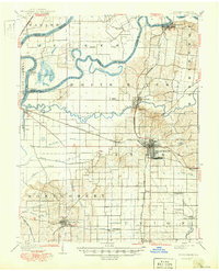
1901 Princeton
Gibson County, IN
1903 Princeton
Gibson County, IN
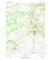
1959 Princeton
Gibson County, IN
1959 Princeton
Gibson County, IN
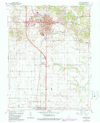
1986 Princeton
Gibson County, IN
2010 Princeton
Gibson County, IN
2013 Princeton
Gibson County, IN
2016 Princeton
Gibson County, IN
2019 Princeton
Gibson County, IN
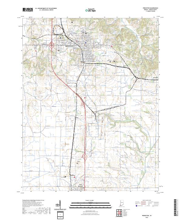
2022 Princeton
Gibson County, IN