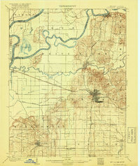
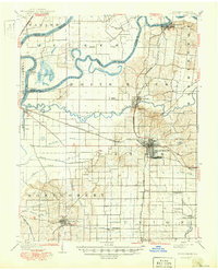
1903 Map of Princeton
USGS Topo · Published 1918About this map
Princeton serves as the focal point of this early twentieth-century survey, surrounded by a complex network of river systems and early industrial infrastructure. The landscape is defined by the confluence of the Wabash River, White River, and Patoka River, which shaped the settlement patterns and agricultural development of Gibson County. A striking historical marker is the Wabash and Erie Canal (Abandoned) in the southeast, providing a clear trace of the mid-19th-century waterway that preceded the rail era.
Find a feature on this map
49 named features on this map. Tap any name to fly to it.
Don’t see what you’re looking for? This feature index may not catch every label — zoom into the map to look around manually.
Map Details
Editions of this 1903 Princeton Map
6 editions found
Other maps of this area

1901 · Princeton
USGS Topo · 1:62,500

1901 · Haubstadt
USGS Topo · 1:62,500

1902 · Ditney
USGS Topo · 1:125,000

1902 · Boonville
USGS Topo · 1:62,500

1903 · Haubstadt
USGS Topo · 1:62,500

1903 · New Harmony
USGS Topo · 1:62,500

1903 · Petersburg
USGS Topo · 1:62,500

1903 · Princeton
USGS Topo · 1:62,500

1903 · Patoka
USGS Topo · 1:125,000

1904 · Mount Carmel
USGS Topo · 1:62,500