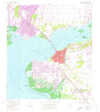
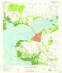
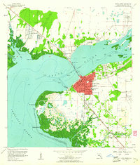
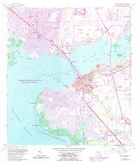
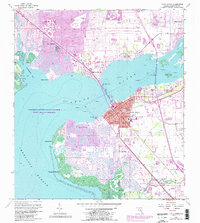
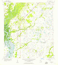
1957 Map of Punta Gorda
USGS Topo · Published 1973About this map
The Peace River and Charlotte Harbor divide this coastal Florida landscape, where the mid-century expansion of Punta Gorda and the rapid emergence of Port Charlotte are captured in detail. The map reflects a significant period of suburban growth, with the complex canal systems of Punta Gorda Isles and Charlotte Park transforming the shoreline near Mangrove Point. Connectivity across the water is defined by the Collier Bridge, while the Seaboard Coast Line railroad tracks run parallel to the coast, serving inland settlements like Acline. Local institutions and historic landmarks are well-documented, from the Charlotte High Sch and Waterworks in the city core to the Indian Springs Cem and an Indian Mound further south. This revision provides a clear record of how the waterfront was re-engineered for residential development prior to the modern era.
Find a feature on this map
35 named features on this map. Tap any name to fly to it.
Don’t see what you’re looking for? This feature index may not catch every label — zoom into the map to look around manually.
Map Details
Editions of this 1957 Punta Gorda Map
5 editions found
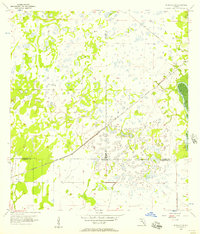
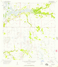
Other maps of this area
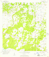
1956 · Murdock
USGS Topo · 1:24,000
1956 · Murdock SE
USGS Topo · 1:24,000
1956 · Cleveland
USGS Topo · 1:24,000
1956 · Ft. Ogden
USGS Topo · 1:24,000
1956 · Punta Gorda SE
USGS Topo · 1:24,000

1956 · West Palm Beach
USGS Topo · 1:250,000

1956 · Tampa
USGS Topo · 1:250,000

1956 · Fort Pierce
USGS Topo · 1:250,000
1956 · Charlotte Harbor
USGS Topo · 1:250,000

1957 · West Palm Beach
USGS Topo · 1:250,000