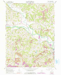
1962 Map of Randle
USGS Topo · Published 1991About this map
The confluence of the Walhonding River and the Tuscarawas River anchors this landscape, where the waterways meet to form the headwaters of the Muskingum River near Coshocton. The topography is defined by the sharp valleys of Killbuck Creek and its tributaries, such as Bucklew Run and Crooked Run. Human impact on the land is visible in the transition from the old railroad grade following the riverbanks to the active strip mines carving into the southern ridges. Notable landmarks like White Womans Rock and Sixmile Dam speak to the area's local history and river management. Scattered rural life is marked by numerous country churches and cemeteries, including the House of Jacob Tabernacle, Antioch Cem, and Pleasant Hill Ch, which serve the small communities of Warsaw and Randle.
Find a feature on this map
42 named features on this map. Tap any name to fly to it.
Don’t see what you’re looking for? This feature index may not catch every label — zoom into the map to look around manually.
Map Details
Editions of this 1962 Randle Map
4 editions found
Other maps of this area

1908 · Conesville
USGS Topo · 1:62,500

1910 · Frazeysburg
USGS Topo · 1:62,500

1910 · Conesville
USGS Topo · 1:62,500

1913 · Brinkhaven
USGS Topo · 1:62,500

1913 · Coshocton
USGS Topo · 1:62,500

1915 · Brinkhaven
USGS Topo · 1:62,500

1915 · Coshocton
USGS Topo · 1:62,500

1943 · Coshocton
USGS Topo · 1:62,500

1950 · Marion
USGS Topo · 1:250,000

1951 · Canton
USGS Topo · 1:250,000