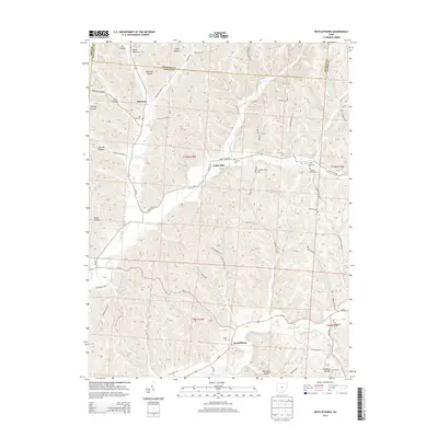
2013 Map of Ratcliffburg
USGS Topo · Published 2013About this map
Ratcliffburg and Jimtown anchor this 2013 survey of the complex ridge-and-hollow terrain along the border of Ross, Hocking, and Vinton counties. The landscape is defined by the deep incisions of Salt Creek and its many tributaries, including Pretty Run, Cox Run, and Stevens Br. This area shows a persistent pattern of rural upland settlement, where homesteads and small communities are tucked into named drainages like Lipscomb Hollow, Brown Hollow, and Conway Hollow.
Find a feature on this map
66 named features on this map. Tap any name to fly to it.
Don’t see what you’re looking for? This feature index may not catch every label — zoom into the map to look around manually.
Map Details
Editions of this 2013 Ratcliffburg Map
This is the sole edition of this map. No revisions or reprints were ever made.
Other maps of this area

1906 · Waverly
USGS Topo · 1:62,500

1906 · Chillicothe
USGS Topo · 1:62,500

1908 · Chillicothe
USGS Topo · 1:62,500

1908 · Waverly
USGS Topo · 1:62,500

1910 · Laurelville
USGS Topo · 1:62,500

1912 · Laurelville
USGS Topo · 1:62,500

1913 · Jackson
USGS Topo · 1:62,500

1944 · Jackson
USGS Topo · 1:62,500

1944 · Laurelville
USGS Topo · 1:62,500

1947 · Columbus
USGS Topo · 1:250,000