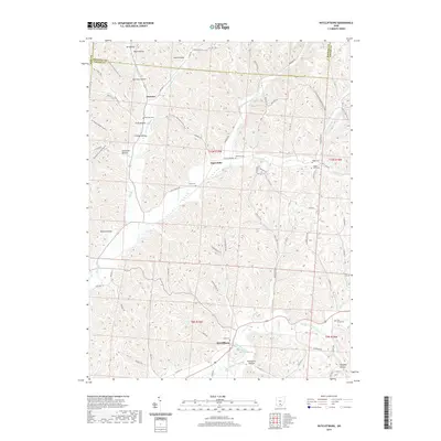
2019 Map of Ratcliffburg
USGS Topo · Published 2019About this map
Eagle Mills and Ratcliffburg serve as the primary hubs in this corner of Vinton County, where the landscape is defined by the winding course of Salt Creek. The topography is a dense network of ridges and hollows, such as Mace Hollow and Ponetown Hollow, which have historically dictated the placement of roads and small settlements like Jimtown. The map reveals a high concentration of rural burial sites, including Union Cem, Lebanon Cem, and the Slagle Cem, which offer significant value for genealogical research in this sparsely populated region. Outdoor recreation and modern land use are represented by the North Country National Scenic Trail and the Tar Hollow Bridle System, which weave through the wooded terrain of Tar Hollow and across the Hocking and Ross county lines.
Find a feature on this map
79 named features on this map. Tap any name to fly to it.
Don’t see what you’re looking for? This feature index may not catch every label — zoom into the map to look around manually.
Map Details
Editions of this 2019 Ratcliffburg Map
This is the sole edition of this map. No revisions or reprints were ever made.
Other maps of this area

1906 · Waverly
USGS Topo · 1:62,500

1906 · Chillicothe
USGS Topo · 1:62,500

1908 · Chillicothe
USGS Topo · 1:62,500

1908 · Waverly
USGS Topo · 1:62,500

1910 · Laurelville
USGS Topo · 1:62,500

1912 · Laurelville
USGS Topo · 1:62,500

1913 · Jackson
USGS Topo · 1:62,500

1944 · Jackson
USGS Topo · 1:62,500

1944 · Laurelville
USGS Topo · 1:62,500

1947 · Columbus
USGS Topo · 1:250,000