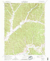
1992 Map of Ratcliffburg
USGS Topo · Published 1995About this map
Salt Creek and its many winding tributaries, including Allen Fork and Middle Fork Salt Creek, dictate the settlement patterns of this Vinton County landscape. Small rural communities like Ratcliffburg and Eagle Mills are situated along the valley floors, where the terrain levels out between the dense ridges of the Tar Hollow State Forest. The map reveals a high density of small family cemeteries and country churches, such as Salt Spring Cem and the Pilgrim Ch, which speak to the deep generational roots of these Appalachian townships. Notable landmarks include an Indian Mound near the creek and the Eagle Sch Ch, indicating the intersection of education and faith in early community life. Scattered oil wells across the eastern portion of the quadrangle reflect the region's long-standing connection to local resource extraction.
Find a feature on this map
46 named features on this map. Tap any name to fly to it.
Don’t see what you’re looking for? This feature index may not catch every label — zoom into the map to look around manually.
Map Details
Editions of this 1992 Ratcliffburg Map
This is the sole edition of this map. No revisions or reprints were ever made.
Other maps of this area

1906 · Waverly
USGS Topo · 1:62,500

1906 · Chillicothe
USGS Topo · 1:62,500

1908 · Chillicothe
USGS Topo · 1:62,500

1908 · Waverly
USGS Topo · 1:62,500

1910 · Laurelville
USGS Topo · 1:62,500

1912 · Laurelville
USGS Topo · 1:62,500

1913 · Jackson
USGS Topo · 1:62,500

1944 · Jackson
USGS Topo · 1:62,500

1944 · Laurelville
USGS Topo · 1:62,500

1947 · Columbus
USGS Topo · 1:250,000