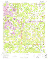
1956 Map of Redan
USGS Topo · Published 1974About this map
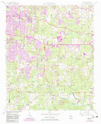
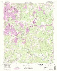
Snapfinger Creek and its many tributaries define this DeKalb County landscape as it underwent significant suburban transformation in the mid-20th century. The original 1956 survey captured a predominantly rural network of country roads like Browns Mill Road and Panola Road, anchored by community landmarks such as Wesley Chapel and Macedonia Ch. By the early 1970s, purple-tinted revisions reveal the rapid expansion of settlements like Glenhaven and Redan, showing the conversion of farmland into residential blocks near Gunn Airfield.
Find a feature on this map
86 named features on this map. Tap any name to fly to it.
Don’t see what you’re looking for? This feature index may not catch every label — zoom into the map to look around manually.
Map Details
Editions of this 1956 Redan Map
7 editions found

Other maps of this area

1888 · Atlanta
USGS Topo · 1:125,000

1890 · Atlanta
USGS Topo · 1:125,000

1892 · Atlanta
USGS Topo · 1:125,000

1895 · Atlanta
USGS Topo · 1:125,000

1953 · Atlanta
USGS Topo · 1:250,000

1954 · Conley
USGS Topo · 1:24,000

1954 · Decatur
USGS Topo · 1:24,000

1954 · Jonesboro
USGS Topo · 1:24,000

1956 · Stone Mountain
USGS Topo · 1:24,000

1956 · Snellville
USGS Topo · 1:24,000