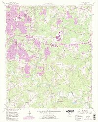
1956 Map of Redan
USGS Topo · Published 1983About this map
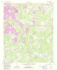
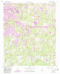
Snapfinger Creek and the South River define the drainage of this DeKalb County landscape, which shows a significant period of suburban expansion into former agricultural lands. The 1956 topography, updated in the early 1980s, reveals the intrusion of the interstate system through neighborhoods like Glen Haven and past Wesley Chapel. While the northern portion of the map is increasingly urbanized, the southern section retains its rural character near the border of Henry and Rockdale Counties. Significant natural landmarks such as Panola Mountain State Park and Arabia Mtn State Park stand in contrast to the growing network of interchanges and subdivisions. Numerous community centers and houses of worship, including Miller Grove Ch and Kelleys Chapel, serve as anchors for established settlements like Redan and Klondike. The presence of the Seaboard Coast Line and older routes like Browns Mill Road highlight the area's transition from a rail-and-mill economy to a modern residential corridor.
Find a feature on this map
84 named features on this map. Tap any name to fly to it.
Don’t see what you’re looking for? This feature index may not catch every label — zoom into the map to look around manually.
Map Details
Editions of this 1956 Redan Map
7 editions found

Other maps of this area

1888 · Atlanta
USGS Topo · 1:125,000

1890 · Atlanta
USGS Topo · 1:125,000

1892 · Atlanta
USGS Topo · 1:125,000

1895 · Atlanta
USGS Topo · 1:125,000

1953 · Atlanta
USGS Topo · 1:250,000

1954 · Conley
USGS Topo · 1:24,000

1954 · Decatur
USGS Topo · 1:24,000

1954 · Jonesboro
USGS Topo · 1:24,000

1956 · Stone Mountain
USGS Topo · 1:24,000

1956 · Snellville
USGS Topo · 1:24,000