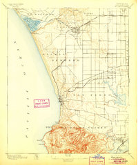
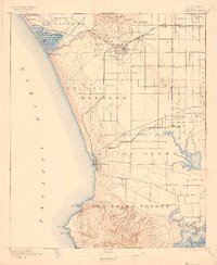
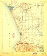
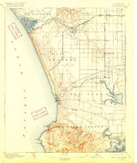
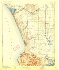
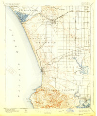
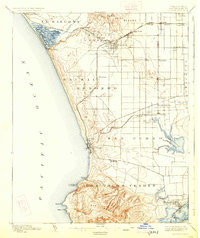
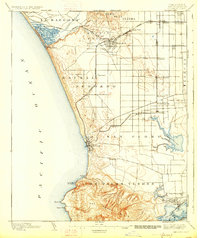
1896 Map of Redondo
USGS Topo · Published 1905About this map
The San Pedro Hills and the coastal bluffs of Los Palos Verdes dominate this late 19th-century survey of the South Bay and Harbor areas. The landscape is a study in early rail infrastructure, featuring the Redondo R. R. and the S. P. R. R. San Pedro Branch serving the maritime hubs of Redondo and Wilmington. Significant historical landmarks appear, such as the Drum Barracks military post and the developing port at Port Ballona. Inland, the map captures a grid of nascent settlements and rural waypoints including Gardena, Moneta, and Strawberry Park, interspersed with natural wetlands like Nigger Slough and Ballona Lagoon. This documentation precedes the massive industrial dredging and harbor expansion of the 20th century, showing Wilmington Lagoon and Mormon Id. in their original coastal configurations before the transformation of the Los Angeles waterfront.
Find a feature on this map
53 named features on this map. Tap any name to fly to it.
Don’t see what you’re looking for? This feature index may not catch every label — zoom into the map to look around manually.
Map Details
Editions of this 1896 Redondo Map
9 editions found
Other maps of this area

1894 · Los Angeles
USGS Topo · 1:62,500

1896 · Pasadena
USGS Topo · 1:62,500

1896 · Redondo
USGS Topo · 1:62,500

1896 · Las Bolsas
USGS Topo · 1:62,500

1896 · Santa Monica
USGS Topo · 1:62,500

1896 · San Pedro
USGS Topo · 1:62,500

1896 · Downey
USGS Topo · 1:62,500

1898 · Santa Monica
USGS Topo · 1:62,500

1899 · Downey
USGS Topo · 1:62,500

1900 · Pasadena
USGS Topo · 1:62,500