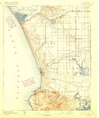
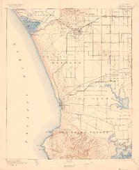
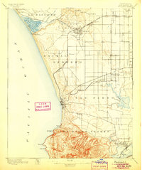
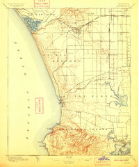
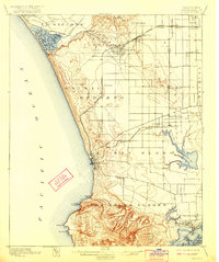
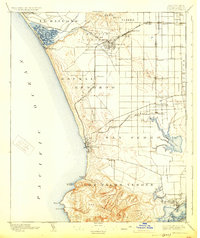
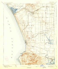
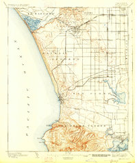
1896 Map of Redondo
USGS Topo · Published 1916About this map
Drum Barracks stands near the burgeoning waterfront of Wilmington, a key landmark on this coastal landscape surveyed in the mid-1890s. The region is defined by expansive land grants such as Sausal Redondo and Paso de la Tijera, where small agricultural and railway settlements like Inglewood, Gardena, and Wiseburn have begun to take root along the Redondo and Atchison Topeka and Santa Fe railroad lines. To the south, the massive San Pedro Hills rise sharply from the Pacific, overlooking a complex shoreline of points and coves including Malaga Cove and Rocky Pt.
Find a feature on this map
52 named features on this map. Tap any name to fly to it.
Don’t see what you’re looking for? This feature index may not catch every label — zoom into the map to look around manually.
Map Details
Editions of this 1896 Redondo Map
9 editions found
Other maps of this area

1894 · Los Angeles
USGS Topo · 1:62,500

1896 · Pasadena
USGS Topo · 1:62,500

1896 · Redondo
USGS Topo · 1:62,500

1896 · Las Bolsas
USGS Topo · 1:62,500

1896 · Santa Monica
USGS Topo · 1:62,500

1896 · San Pedro
USGS Topo · 1:62,500

1896 · Downey
USGS Topo · 1:62,500

1898 · Santa Monica
USGS Topo · 1:62,500

1899 · Downey
USGS Topo · 1:62,500

1900 · Pasadena
USGS Topo · 1:62,500