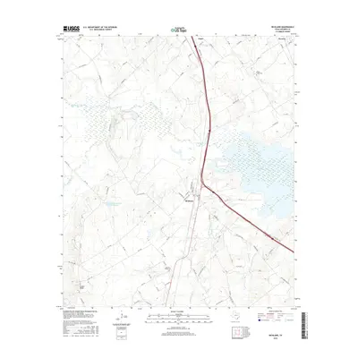
2016 Map of Richland
USGS Topo · Published 2016About this map
Richland serves as a central hub in this Navarro County landscape, where the convergence of modern transit and traditional creek-fed lowlands defines the local geography. The corridor of the Interstate 45 frontage road cuts a straight line through the territory, passing between the waters of Love Lake and the extensive Texas Industries Lake to the east. The terrain transitions from the alluvial plains of Richland Creek and Mesquite Cr to the more prominent elevations of Pisgah Ridge in the southwest corner. For those tracing family ties to the area, the map preserves the locations of several community landmarks, including the Grape Creek Cem near Navarro and the Carroll Chapel Cem further south. This 2016 survey also documents significant water management efforts, such as the Soil Conservation Service Site 36 Reservoir, which reflects the ongoing modification of the Pin Oak Cr drainage system.
Find a feature on this map
81 named features on this map. Tap any name to fly to it.
Don’t see what you’re looking for? This feature index may not catch every label — zoom into the map to look around manually.
Map Details
Editions of this 2016 Richland Map
This is the sole edition of this map. No revisions or reprints were ever made.
Other maps of this area

1954 · Dallas
USGS Topo · 1:250,000

1954 · Waco
USGS Topo · 1:250,000

1955 · Waco
USGS Topo · 1:250,000

1958 · Dallas
USGS Topo · 1:250,000

1959 · Powell
USGS Topo · 1:24,000

1960 · Streetman
USGS Topo · 1:24,000

1963 · Richland
USGS Topo · 1:24,000

1963 · Wortham
USGS Topo · 1:24,000

1963 · Kirvin
USGS Topo · 1:24,000
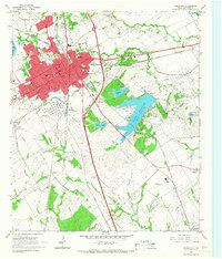
1965 · Corsicana
USGS Topo · 1:24,000