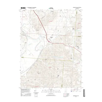
2016 Map of Richmond Dale
USGS Topo · Published 2016About this map
Richmond Dale and Vigo serve as central nodes in this pocket of Ross County where the Scioto River meets the winding Salt Creek. The landscape is a complex mix of agricultural bottomlands and prominent landforms like Weddington Hill and Buzzard Rock. Industrial presence is marked by the Southern Silica Pond Number One and Southern Silica Pond Number Two, while the N Country National Scenic Trail (Buckeye Trail) traces a path through the western hills.
Find a feature on this map
127 named features on this map. Tap any name to fly to it.
Don’t see what you’re looking for? This feature index may not catch every label — zoom into the map to look around manually.
Map Details
Editions of this 2016 Richmond Dale Map
This is the sole edition of this map. No revisions or reprints were ever made.
Other maps of this area

1906 · Waverly
USGS Topo · 1:62,500

1906 · Chillicothe
USGS Topo · 1:62,500

1908 · Chillicothe
USGS Topo · 1:62,500

1908 · Waverly
USGS Topo · 1:62,500

1910 · Laurelville
USGS Topo · 1:62,500

1912 · Laurelville
USGS Topo · 1:62,500

1913 · Jackson
USGS Topo · 1:62,500

1944 · Jackson
USGS Topo · 1:62,500

1944 · Laurelville
USGS Topo · 1:62,500

1947 · Columbus
USGS Topo · 1:250,000